Quick Aerial Image Analysis From Your Aerial Survey Flights
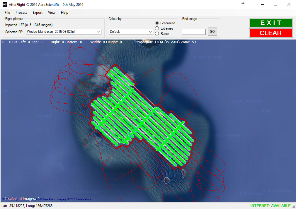
AfterFlight is an Aerial Image Processing Software that allows the user to quickly and efficiently perform aerial image analysis and collect metadata from an aerial survey flight, allowing aerial photo interpretation to become easy.
It can be used in the air, or on the ground. With this software, you know immediately whether there were any problems with the acquisition. This is why it is so useful: it means that problems can be identified straight away, and fixed while you are still in the air.
But it does much more than identify any potential problems with the data capture: it also allows the user to synchronise the acquired imagery with metadata (GPS positions), generate statistics from the acquisition flight, and export the metadata in new formats.
You can download a flyer describing AfterFlight here (PDF).
In The Air — Aerial Image Processing Software
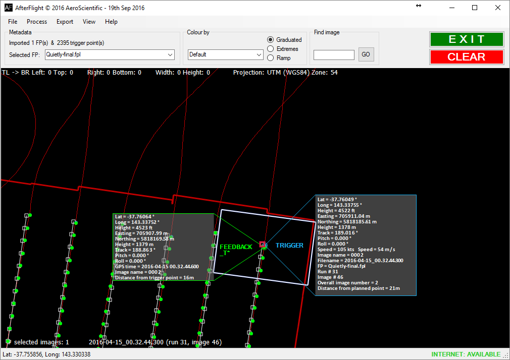
As you turn off the last flight run, AfterFlight will give you all the statistics of the acquisition, including:
- the number of frames that were captured
- the mean and standard deviation of the distance actual trigger points from the planned ones
- whether any trigger points were ‘out of tolerance’, for example the trigger point was too far from the planned point
- whether there will be any gaps in the final data set
By knowing this information whilst still in the air, and still in the survey area, it is possible to go back and refly any flight lines that need reflying. It is far better to fix any acquisition problems straight away, rather than having to return at a later date.
On The Ground — Aerial Image Processing Software
AfterFlight enables the synchronisation of image data and GPS data, to aid image processing. Specifically, AfterFlight can be used to write image names into metadata files, and it can write GPS data (latitudes and longitudes) into image EXIF headers.
Our Aerial Photo Analysis Software Compatibility
AfterFlight only works alongside our other Flight Management software, Aviatrix. This allows easy integration to do aerial photography and image interpretation, meaning you can gather our aerial image results much faster.
Try Out AfterFlight Before You Buy
As with all of our software products, we encourage potential clients to try the software before they purchase it. Please contact us for a demo version of AfterFlight (fully functional but time-limited), so that you can try the software for yourself. We’ll provide plenty of sample data for you to experiment with.