Linear Mapping. The Path Drawing Tool
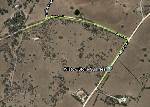
A poly-linear/linear (or path) flight plan can be created using the path drawing tool, this is also called linear mapping. This tool is usually used to follow a road, coastline, or border terrain. You may also import poly-linear/linear flight plans as well.
Once you’ve fully drawn your path flight plan, you can then proceed with the project parameters.
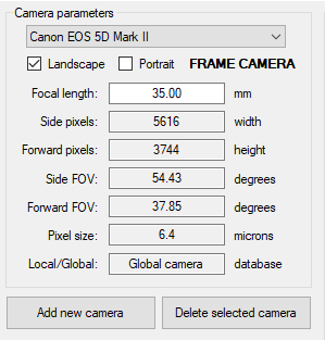
Linear Mapping Camera Parameters
There is a pre-set number of cameras available to choose from within the project parameters. You may even choose to add a new camera, although you need to input the following details:
- Focal length (mm)
- Side/forward pixels (width/height)
- Side/forward FOV (degrees)
- Pixel side (microns)
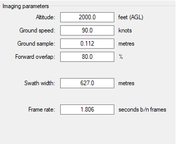
Linear Mapping Imaging Parameters
In the imaging parameters section, you can modify the quality, the number of images you take, and other parameters that affect your image results. Here are the following imaging parameters you can modify.
- Altitude (above ground level): Your aircraft’s altitude in feet during the aerial survey
- Ground speed: Your aircraft’s speed in knots
- Ground Sample: The GSD of your images in metres
- Forward overlap (%): The amount each image overlaps with each other, increasing the overall accuracy of your mapping results
- Swath Width: Determines the width of all your images in metres
Note: You cannot adjust the altitude, ground sample, and swath width after creating the flight plan.
Viewing a Path/Linear Map Flight Plan
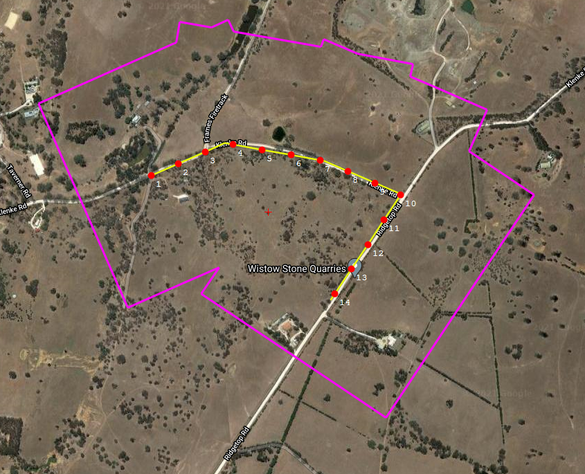
The camera stations are shown as red dots, numbered sequentially from the start to the end of the path. The purple boundary shows the complete image coverage, keep an eye on this boundary to ensure everything you intend to capture is within this area.
A path flight plan can be modified by selecting points or line segments to be deleted. The other tools for modifying polygon flight plans (rotate, North-South lines, etc.) cannot be applied to a path flight plan.